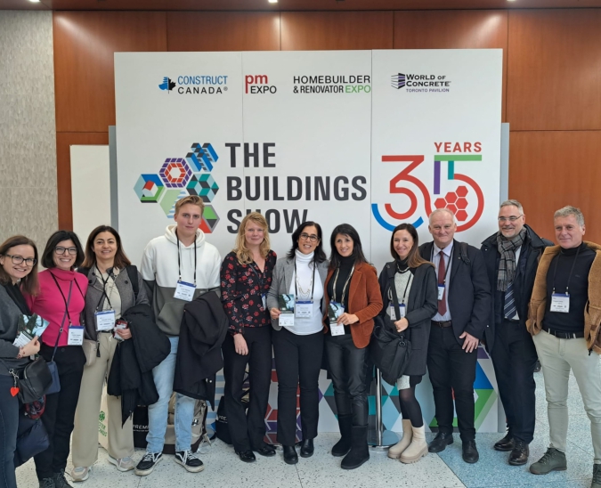
With the support of Archenerg Cluster, Lőrinc Márkus, as a representative of Ambisza Kft, travelled to Toronto, Canada, to attend The Buildings Show, a building exhibition, as part of the ICBUILD project. In addition to the exhibition, he also participated in an exciting workshop where the companies participating in the project could get to know each other. We asked Lőrinc Márkus about his experiences and the project.
- What was the exhibition about?
- The exhibition brought together companies from all corners of the construction industry, mainly international companies, to showcase their products and services. Companies from a wide range of activities participated, from building materials manufacturers to construction service providers, innovative designers and survey companies.
- What was the most interesting part of the exhibition?
- I was most interested in the presentations of start-ups working in the field of spatial computing. For example, I was able to see how a robot works that can automatically move around and map the floor plan of a building under construction, detecting any deviations from the plan in time. I also got to know a Canadian ironwork company that has developed virtual reality software to show plans to customers who are not on site. Many similar ideas and solutions were presented at the exhibition that will make parts of the construction industry easier and faster in the near future. But the most exciting part was the workshop, where I was able to meet other European construction-related companies. Here I was able to present our own services to the participating companies and to make contact with companies with which we hope to establish partnerships in the near future.
- How did the Archenerg Cluster help you, beyond being able to participate in the fair?
- With the help of the Archenerg Cluster I have been able to establish contacts with many European companies that are similarly active in the construction industry. We have discovered joint cooperation opportunities with several companies, which will hopefully lead to joint projects in the future.
- How long have you been involved in geospatial solutions?
- A couple of years ago, in 2021, I founded AirScan with a friend, a company that deals with various geospatial solutions. Our services include point cloud surveys using laser scanners, which are often ordered by engineers and architects to survey buildings or objects. With a laser scanner, we can produce a complete digital copy of an object with millimetre accuracy, whether it is a large object or an entire building. Once the object has been digitised, measurements can easily be taken on the digital model, making design and quality control faster and more cost-effective. We also carry out various types of drone surveys, and can model large areas, spaces or even buildings using photogrammetry. These surveys are carried out by drone, using high-resolution photographs. Geomatics makes many aspects of the construction industry easier, more cost-effective and faster. At a regional level, solutions such as laser scanning point cloud surveys or drone photogrammetric surveys can be an important part of smart city planning or even the design of individual buildings. In addition to the design phase, a variety of 3D surveys also play an important role in the quality control of buildings.
- Which project are you most proud of?
- We tailor our services entirely to the project and are happy to develop new solutions for individual needs. In the summer of 2023, we were commissioned to carry out thermal radiation testing for the entire area of Budapest districts VI and VII. The survey was carried out with a thermal imaging drone, which was used to take thermal images of the entire area of the two districts on a pre-programmed flight path after sunset on a hot August day. From the recorded thermal images, a heat map was subsequently compiled, from which the heat emissions of different surfaces (building, asphalt, park, etc.) can be transparently examined. We are the only company in Hungary to have carried out such a comprehensive thermal imaging survey over such a large area, and I am very proud of this.
- Was it important for the survey to take place in the summer, or can such a survey also be done in the winter?
- For this particular thermal camera drone survey, it was important that the measurements were taken after sunset on a warm summer day, because the client company was looking at the thermal radiation and thermal conductivity of different surfaces. With such a thermal camera drone survey, a lot of information will be visually visible that would otherwise not be known. Such a survey can be done for different purposes at different times of the year. For example, if a municipality or a district wants to investigate the thermal insulation of residential buildings, it is worthwhile to carry out a thermal survey in winter, during the heating season. If the heat storage properties of different surfaces need to be investigated, it is worth investigating the thermal situation of the area in the summer following a major heat wave.
- What type of drone should be used for a photogrammetric survey and how long should one fly to get a stable and accurate survey?
- For photogrammetric surveys, it is very important that the drone has a good quality camera. This can be a compactly purchased drone or a self-built drone with an interchangeable camera. It is important that the drone is reliable and can be precisely controlled, as it is often necessary to manoeuvre in tight spaces or even close up. In addition, it is important that the time in the air with a battery is as long as possible (20-40 minutes), because if you are doing a complex photogrammetric survey, you may need a long flight time to take pictures or thermal images from all the necessary angles. Flying with drones is relatively easy thanks to the technological advances (GPS position keeping, collision avoidance sensors, etc.), and almost anyone can master the technique in a few hours of practice. However, to be prepared for all special cases, such as sudden changes in weather conditions, flying in narrow places, unexpected loss of signal, a pilot needs a lot of practice. We have made more than a thousand successful take-offs and flown hundreds of hours with different drones.
- How does such a survey work, can you explain it step by step:
- The first and most important step is planning. In the planning phase, you need to obtain the necessary airspace and other permits for the flight. You have to plan in advance the route you want to fly, in many cases this is pre-programmed for automatic flights. It is also important to plan for suitable weather conditions so that the flight can be carried out safely. During the fieldwork we record the data needed for the project, in most cases photographs and thermal images. It is important that the flight is carried out safely, following all the required rules. If the flight time required for the project is long, we must ensure that we can charge the batteries. For our thermal imaging surveys, we use a mobile office bus to carry out the survey on site, where we have a power source available and can start processing data while the survey is still in the field. The data processing is usually the longest part of the drone survey, taking up about 70% of the work. The captured data (images and thermal images) are sorted, polished, normalised and then processed using photogrammetric software to produce a 3D model or orthophoto from which accurate measurements can be taken.
- What advice would you give to people who are interested in this?
- I think that nowadays there is an increasing demand for this kind of geospatial surveys in construction, agriculture, urban planning and many other industries. Fortunately, more and more companies and municipalities are realising that many projects can be made more efficient and costs can be reduced by using GIS solutions. That's why I recommend geospatial to anyone who wants to take advantage of technological advances and changes.
Source: Ádám Kovács-Jerney